My research focuses on understanding complex processes occurring on Earth’s surface and climate system. Such processes include groundwater movement, surface wetland, dynamic crop growth, and regional climate interactions. Human management, such as irrigation and wetland drainage, also plays a crucial role in modifying these natural landscapes.
To answer the above questions, I rely heavily on computer models to simulate the geophysical processes on Earth’s surface and atmosphere.
1. Soil moisture-atmosphere feedback manifests seasonal predictability for heatwaves
Soil moisture, as important storage of terrestrial water, exhibits short-term feedback from springtime hydrological conditions that will add predictive values in summertime extreme temperatures. This feedback is facilitated through the evapotranspiration process that couples both surface energy and water balance. In this study, the soil moisture feedback is examined in both large-scale observational networks and high-resolution convection-permitting regional climate models (Zhang et al. 2018, Climate Dynamics).
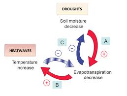
Source: Seneviratne et al. (2010)
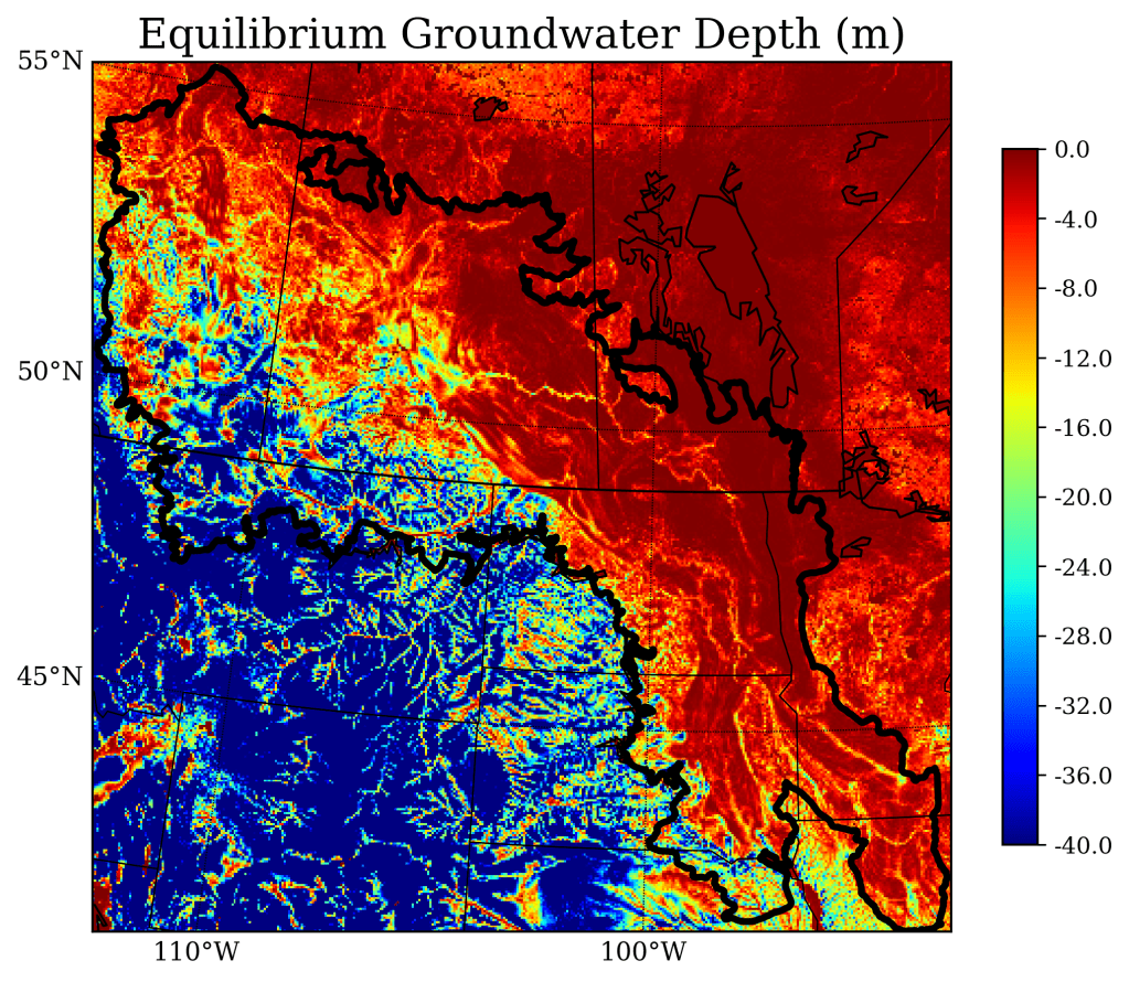
2. Modeling shallow groundwater movement in the Prairie Pothole Region
The Prairie Pothole Region (PPR) is an extensive region across the US-Canada border, with unique hydrological and biodiversity functions. In particular, the region’s shallow groundwater plays a critical role in water resource management, agricultural production, and biodiversity. In this study, a novel and physical processed-based groundwater model is applied to simulate the hydrological shifts in this region under future climate change scenarios (Zhang et al. (2020), Hydrological and Earth System Sciences).
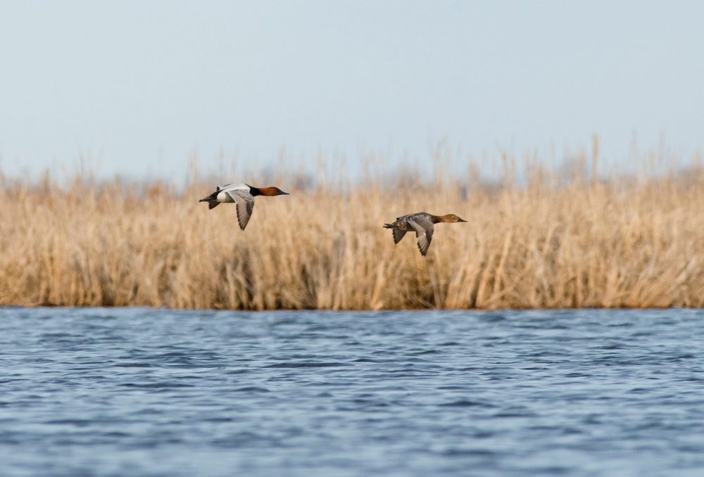
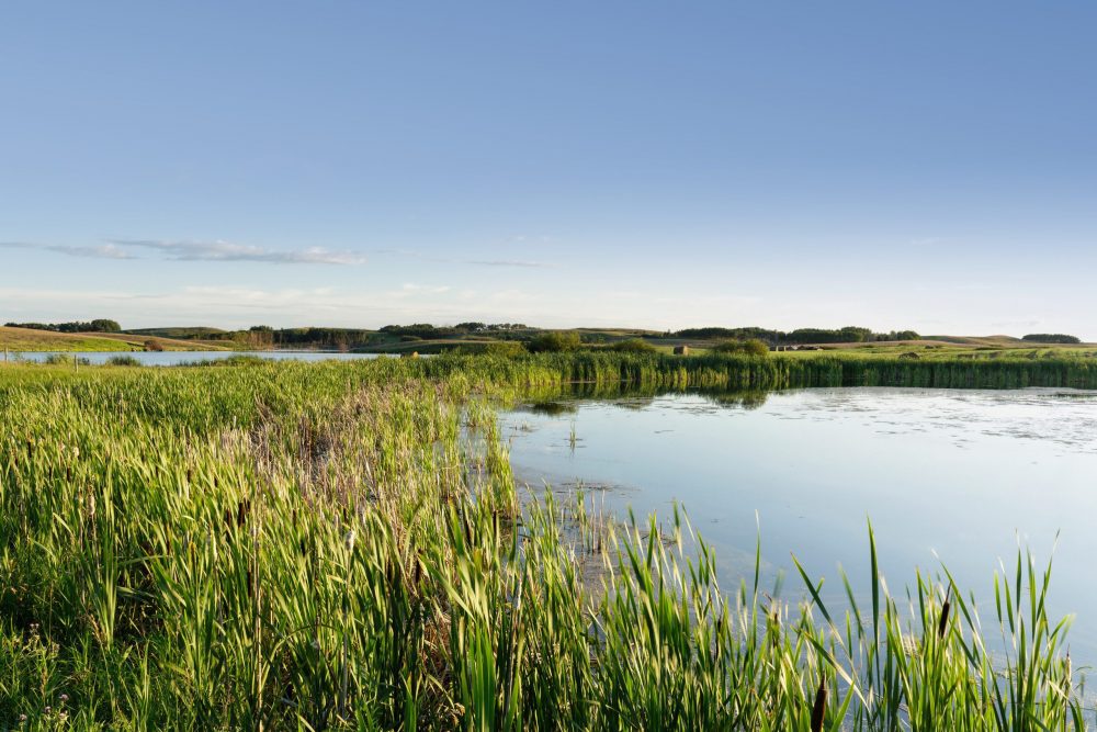
3. Prairie wetlands’ connection with groundwater and climate change
Climate change has imposed significant challenges to the prairie wetlands, for their ecological services as breeding habitats for migratory waterfowl. In this study, we aim to understand where these wetlands would be most strongly impacted and how these processes would occur. This work is conducted through the dynamical downscaling of global climate models (GCMs) and coupled with the land surface-hydrological model (Noah-MP LSM) (Zhang et al., 2021, Water Resources Research).
(This study is in collaboration with Ducks Unlimited Canada and Mitacs Canada)
4. Wetlands’ cooling effects amidst land use and climate change
Wetlands’ hydrological effects and feedback to the atmosphere were particularly important but neglected or simplified in previous climate model studies. This is because the distribution, storage, and seasonal variability of surface water wetlands have been difficult to capture. In this study, we conducted implemented a novel surface wetland scheme to simulate wetland distribution and their feedback to the atmosphere, with the constraint of a global remote sensing dataset. The study shows evident cooling effects with 1~3 C in contrast to the neglecting wetland scenario (Zhang et al. 2022, Water Resources Research).
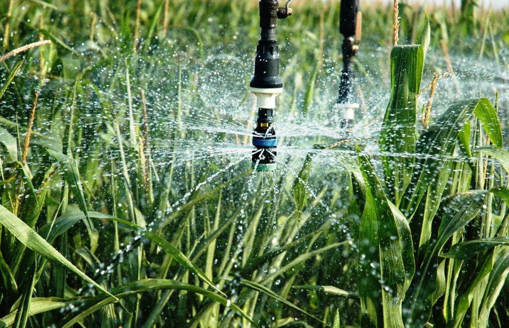
5. Joint modeling efforts for dynamic crop growth and irrigation water use in the US cornbelt
Irrigation plays an important role in stabilizing crop yields, especially in semi-arid regions, such as Nebraska. The ability to accurately model both crop growth and irrigation water use provides a crucial understanding of the food-water nexus, especially facing challenges from climate change. (Zhang et al. 2020, Journal of Advances in Modeling Earth Systems)